EXPEDITION TO CENTRAL AFRICA
August Petermann 1854
An account of the progress of the expedition to Central Africa in the years 1850, 1851, 1852, and 1853, under Richardson, Barth, Overweg and Vogel, consisting of maps and illustrations with descriptive notes, London and Gotha 1854.
Book details
Electronic Facsimile Edition
Mandaras Publishing 2010
Ramsgate, Kent (UK)
ISBN 978-1-906168-06-3
About this royal folio e-book
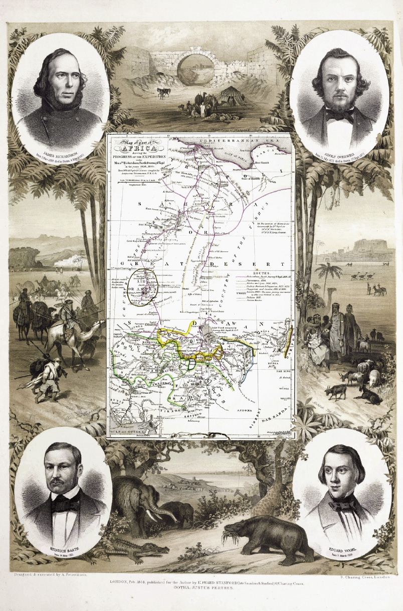
Petermann had received letters from Heinrich Barth during the expedition which he used in his royal folio before Barth’s return. As well known international mapmaker, Petermann was mainly interested in the expedition’s cartographical information. His work resulted in a first cartographic map of sub-Saharan Africa, which is also depicting the southern lake Chad basin and the Mandara mountains in great detail. The two maps at the end of this electronic facsimile edition can be enlarged so that all the geographical details are clearly visible.
About Ferdinand Moras frontispiece
Moras was a lithographer who came originally from Wuppertal in Germany. He met Petermann in London and became later famous in Philadelphia. His lithograph shows a map in the centre, framed by geographically informed illustrations of the main stations of the expedition. The bottom illustration represents lake Chad. The four portraits show the main expedition members. Heinrich Barth turned out to be the only survivor of these four 19th century trans-Saharan explorers.